We are now delivering all our products to your location, keeping in mind all the safety measures.
India Political Map - Art Paper (27.55" W x 33" H)
")
- Wish
- Compare
- Brand - Maps of India
- Product Code - MOI-P9276
- Availability - 2 - 3 Days

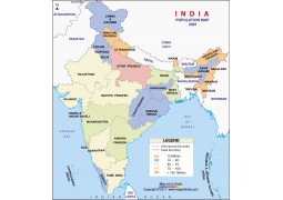
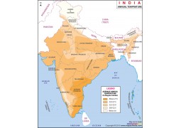
India Political Map portrays states in different colors demarcated with
state boundaries. Names of capital cities, country capital New Delhi
along with the neighboring countries Pakistan, Bangladesh, China, Nepal
etc. are also shown on the map. Newly made state Telangana also depicted
on the map.This map is useful for presentations, project works, general
studies, cartographic work and teaching purposes. places, rivers and
lakes, airports, seaports and all major Designed for international
travelers, this map is the most up-to-date map you can get on the
country. The map includes all major highways, the great Indian rail
network, national parks, beaches, important pilgrimage tourist places of
interest. It also includes the recently developed North South corridor,
East-West corridor and the Golden quadrilateral highways. The map also
has distances between major towns in the country, thus making it easier
for a traveler to plan out his journey. Boundaries are approved by
Survey of India. We follow editorialcalls.org for border and boundary
demarcations. Map Size 27.55" W x 33" H
-
 Rs.999.00
-
Rs.1,200.00
-
 Rs.999.00
-
Rs.1,200.00
-
 Rs.999.00
-
 Rs.1,200.00
-
 Rs.999.00
-
Rs.1,200.00
-
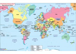
Buy Spanish World Map with Countries (Mapa del Mundo Politicos) from store mapsofindia available in vector AI(Adobe Illustrator),...
 Rs.999.00
-
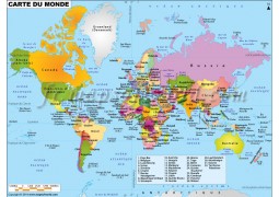
Buy french world map (Carte De Monde) from www.store.mapsofindia.com available in vector AI(Adobe Illustrator), Map availabl...
 Rs.999.00
-
Map of India detail wall map. Getting accurate and up-to-date information on India is tough, but the India Wall Map makes it eas...
 Rs.300.00
