We are now delivering all our products to your location, keeping in mind all the safety measures.
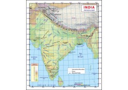
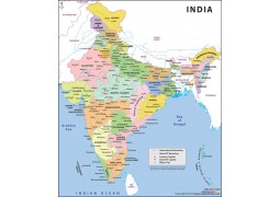
Political Map of India

- Wish
- Compare
- Brand - Maps of India
- Product Code - MOI9001
- Availability - 100
Qty

Note for Printed Maps: Delivery time for all physical products is between 3 - 5 business days based on your location in India. Exceptions apply. For other shipping locations, mail us at [email protected].
Specification & Review
The India Political Wall Map shows all the states and union territories along with their capital cities. The states are marked in different colors along with their administrative boundaries. The map accurately depicts international boundaries as well. Approved by the Survey of India, this aesthetically represented map measures 27.5 x 32 inches.
This digital map is available in editable vector formats such as AI, EPS and layered PDF and non-editable raster formats like, 72 and 300 DPI JPEG
Please Note : You will require Adobe Illustrator software to edit AI/EPS/PDF files.
-
 Rs.999.00
-
 Rs.999.00
-
 Rs.999.00
-
 Rs.999.00
-
 Rs.1,200.00
-
 Rs.999.00
-
 Rs.999.00
-
 Rs.999.00
-
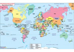
Buy Spanish World Map with Countries (Mapa del Mundo Politicos) from store mapsofindia available in vector AI(Adobe Illustrator),...
 Rs.999.00
-
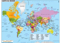
Buy french world map (Carte De Monde) from www.store.mapsofindia.com available in vector AI(Adobe Illustrator), Map availabl...
 Rs.999.00
-
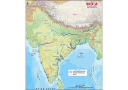
Map of India detail wall map. Getting accurate and up-to-date information on India is tough, but the India Wall Map makes it eas...
 Rs.300.00
